.....ARTIST....// .....ORDERING.....//.....HOME..................Hello: This part of the web site has nothing to do with art.It is about the natural history of the studio/gallery (you might want to hit the back arrow key).Hydrology-The study of water
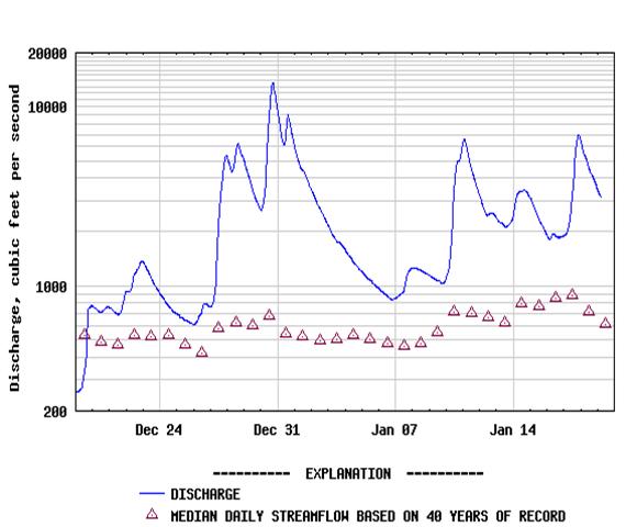
I happen to be a professional hydrologist so I would like to share with you a description on the hydrology of Little River and even included Rattlesnake Creek, a small tributary we live near. I worked for the U. S. Geological Survey (USGS) for 15 years prior to arriving in Glide, Oregon. I authored numerous publications on ground water, water quality, surface water, seismic refraction, and even evapotranspiration. I still work in the field doing mostly stream restoration, stream surveys, and water quality sampling. During my spare time I have made numerous observations about the streams. Little River actually "collides" head on with the North Umpqua River and later joins the South Umpqua to form the Umpqua River that empties into the Pacific Ocean. The Little River watershed is 206 square miles and ranges in elevation from 750 feet (225 meters) to 5,275 feet (1,600 meters).Higher elevations receive over 80 inches of annual precipitation (rainfall equivalent), much of which accumulates as snow at elevations above 2,000 feet. Lower elevations average 40 inches of rainfall annually. Click for a detailed description on the water quality of Little River. The USGS maintains a stream gage about one mile upstream of Rattlesnake Creek. For "real time" streamflow data click on this link Little River. If you want to find data on a stream near you go to this site: Real time data for the nation. A recent hydrograph of Little River,
courtesy of the USGS :
|
|
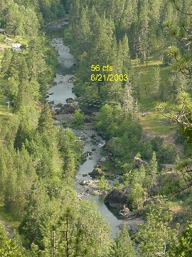 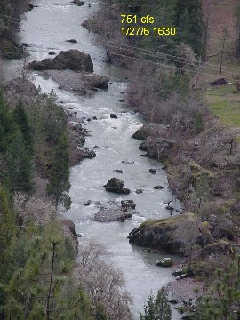 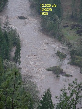 |
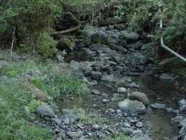
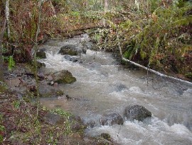
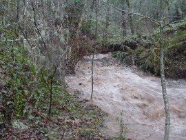
| Rattlesnake Creek is a small drainage, 1.75 square miles, which flows into Little River. It is an A to AA+ channel. That means it is a headwater stream with a steep gradient of over 10%. We live near the mouth of Rattlesnake Creek. The creek can really get moving when the rainfall exceeds an 1 inch in 24-hours. We pump our water from the creek 400 feet uphill to a holding tank. The studio is at an elevation of about 1,200 feet. The following photos are a comparison of three different flow events on the creek. |
   |
|
|
Any comments please send to: [e] duell@centurytel.net